Microburbs
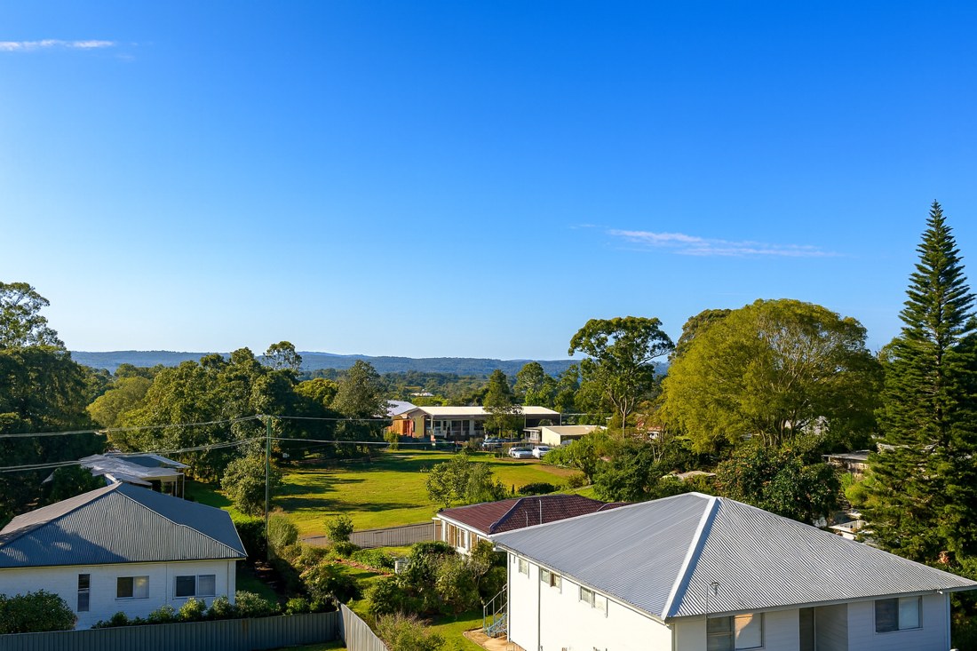
Russell Island, QLD, Houses with trees and distant hills

Houses with trees and distant hills

AI impression

The quick read on

Russell Island

QLD 4184 · Redland

What homes cost, how rents have moved, and a feel for the people who call it home.

Median house
$460,000

latest suburb median

Population
3,698

ABS 2021

Postcode
4184

Russell Island, Queensland

Property market insights for Russell Island

Median sale price and rental income of properties in Russell Island QLD

Median price trend for houses

Based on 285 sales in the preceding 12 months

$460,000

Up 4.8% over 12 months

$600k$400k$200k20212023202420252026
1 bed
$349k
2 bed
$465k
3 bed
$535k
4 bed
$680k

Median rent trend for houses

Based on 127 rental listings in the preceding 12 months

$450 per week

Up 5.9% over 12 months

$450$400$350$30020212023202420252026

Market data updated October 2026.

The median house price in Russell Island, QLD is currently $460,000, based on the latest 12 months of sales. Russell Island has a 12-month growth rate of 4.8% for houses.

One-bedroom houses have a median sale price of $349,000, Two-bedroom houses have a median sale price of $465,000, Three-bedroom houses have a median sale price of $535,000, Four-bedroom houses have a median sale price of $680,000 in Russell Island.

If you're looking to lease, the median rent for houses in Russell Island is $450 per week. The median house rent has increased 5.9% over the last 12 months.

The median rent for units and apartments in Russell Island is $362 per week and has increased 3.4% over the last 12 months.

Crime and safety

Is Russell Island safe?

The overall rate for Russell Island is 1,559 offences per 100,000 residents — 27% above the Greater Brisbane benchmark.

That is the clearest suburb-wide answer. Open the detailed profile to see how the pattern changes across offence types and different parts of Russell Island.

Overall crime rate

1,559

offences per 100,000 residents

27% aboveGreater Brisbane

Russell IslandGreater Brisbane: 1,229

Suburb-wide estimate from Microburbs' public crime model; it is not an address-level measure.

The people behind the postcode

Who lives in Russell Island?

Russell Island QLD 4184 is in Queensland, within Greater Brisbane.

3,698 people call Russell Island home, with an average of 1.9 people per household and a median household income of $756 a week.

Public ABS 2021 Census figures. The bars compare the local share with the capital-region benchmark.

Population
3,698
Median age
59 years
Median mortgage
$867 / month
2021 household rent
$260 / week
Above the benchmarkBelow the benchmarkIn lineGreater Brisbane benchmark

Age profile

Share of residents in each age band.

Under 159.6%Below
15–3410.5%Below
35–5421.6%Below
55–7446.0%Above
75 and over12.2%Above

Homes

Share of occupied private dwellings.

Separate houses98.5%Above
Townhouses0.0%Below
Apartments0.0%Below

Ownership

Share of homes with a stated ownership or rental status.

Owned outright50.5%Above
Paying a mortgage22.9%Below
Renting26.6%Below

Cars at home

Vehicles available to occupied households.

No car11.1%Above
One car51.4%Above
Two cars28.8%Below
Three or more9.2%Below

Getting to work

Selected ways residents worked or travelled on Census day.

Worked from home14.3%Below
Drove to work31.6%Below
Train, tram or bus0.0%Below
Walked or cycled4.8%Above

What stands out in Russell Island

14.3% of workers in Russell Island worked from home on Census day — less common than across Greater Brisbane.

7.5% of Russell Island residents were born in New Zealand, noticeably more common than across Greater Brisbane.

38.6% of people in Russell Island described themselves as having no religion in the 2021 Census.

A closer look at the Census

Questions people ask about Russell Island

Open any question for a plain-English reading of the public 2021 Census for Russell Island QLD 4184.

Is Russell Island family-friendly?Age, family structure and household size describe the community families would be joining.

9.6% of Russell Island's residents were children under 15 in the 2021 Census. That is about half the Greater Brisbane rate.

973 family households lived in Russell Island; 18.4% were couple families and 20.9% were one-parent families.

19.0% of local families included children under 15. That is about half the Greater Brisbane rate.

These are suburb-wide household figures, not school or childcare ratings.

What is the age profile of Russell Island?The balance between younger adults, families and older residents changes how a suburb feels day to day.

Russell Island had 3,698 residents at the 2021 Census.

12.0% of residents were aged 25 to 44.

58.2% were 55 or older. That is about twice the Greater Brisbane rate.

Age shares use the suburb’s total Census population.

What kind of homes are in Russell Island?The dwelling mix shows whether the suburb is mostly detached homes, townhouses or apartments.

Separate houses made up 98.5% of occupied private dwellings in Russell Island.

Townhouses and other attached homes represented 0.0% of occupied private dwellings.

Flats and apartments accounted for 0.0% of occupied private dwellings.

All three shares use occupied private dwellings as the denominator.

Do people own or rent in Russell Island?Tenure shows how many households own outright, have a mortgage or rent.

50.5% of households with a stated tenure owned their home outright. That is about twice the Greater Brisbane rate.

22.9% were buying their home with a mortgage.

26.6% rented their home. That is well below the Greater Brisbane average.

Tenure shares include households that stated one of these three arrangements.

How large are households in Russell Island?Household-size data shows the mix behind the suburb-wide average.

The average household in Russell Island had 1.9 people.

One-person households made up 40.0% of occupied homes. That is well above the Greater Brisbane average.

Two-person households represented 42.3%, while 7.0% had four or more usual residents.

Household size counts usual residents in occupied homes.

How do people get to work in Russell Island?Census-day travel shows the balance between home, road, public transport and active travel.

14.3% of workers worked from home on Census day. That is somewhat below the Greater Brisbane average.

31.6% drove a car as their only travel method. That is well below the Greater Brisbane average.

0.0% used only a train, tram or bus, while 4.8% walked or cycled.

Travel figures are a 2021 Census-day snapshot.

How many cars do households have in Russell Island?Vehicle availability helps describe the routines local households can support.

11.1% of occupied households had no motor vehicle available. That is somewhat above the Greater Brisbane average.

One-car households formed 51.4% of the total.

38.0% of households had two or more vehicles.

Vehicle counts refer to occupied households, not individual residents.

Who's moving to Russell Island, and who stays?Address history shows how settled or recently mobile residents were at the Census date.

47.6% were at the same address five years earlier, while 52.4% reported a different address.

23.4% of residents were born outside Australia. That is somewhat below the Greater Brisbane average.

Mobility figures cover residents who answered the relevant Census question.

What languages are spoken in Russell Island?Language at home gives a direct view of the community’s everyday linguistic mix.

85.8% of residents used only English at home.

5.1% used a language other than English at home.

0.0% spoke Mandarin at home, 0.0% spoke Cantonese and 0.0% spoke Hindi.

Home language is separate from English proficiency.

Where were Russell Island residents born?Birthplace adds another layer to the local story, separate from ancestry and language.

23.4% of Russell Island's population was born outside Australia, while roughly 76.6% was born in Australia.

0.1% of residents were born in China.

0.2% were born in India, while Australian citizenship across the whole suburb stood at 83.2%.

Birthplace, citizenship and ancestry describe different parts of identity.

What ancestries shape Russell Island?Ancestry responses show how residents describe family and cultural background.

English ancestry accounted for 44.7% of ancestry responses in Russell Island.

Australian ancestry made up 31.7% of responses.

Chinese ancestry represented 0.4% of responses.

People may nominate more than one ancestry, so these are shares of responses.

What work do people do in Russell Island?Occupation describes a person’s role; industry describes the sector employing them.

11.5% of employed residents worked in professional occupations. That is about half the Greater Brisbane rate.

Managers accounted for 8.7% of employed residents, while clerical and administrative workers made up 9.0%.

Health care and social assistance employed 16.7% of workers, and education and training employed 5.3%.

Occupation and industry figures describe employed residents of the suburb.

How active is the workforce in Russell Island?Participation, employment pattern and unemployment describe the resident labour force.

The labour-force participation rate was 30.1%, compared with 64.5% across Greater Brisbane.

10.4% of residents aged 15 and over worked full time, while 11.6% worked part time.

Unemployment was 14.2%, compared with 5.5% across Greater Brisbane.

Labour-force figures come from the 2021 Census.

What does the health profile of Russell Island show?Selected long-term health conditions help describe community service needs.

36.0% reported no selected long-term health condition.

18.6% reported a long-term mental health condition, including depression or anxiety.

11.9% reported asthma, 21.4% arthritis and 8.5% diabetes excluding gestational diabetes.

These are self-reported suburb-wide Census figures, not address-level health risks.

How educated is Russell Island?Qualifications describe the study pathways represented among local residents.

11.8% of people in the qualifications table held a bachelor degree. That is about half the Greater Brisbane rate.

Postgraduate degrees accounted for 2.7% of qualification responses.

Diploma-level qualifications represented 15.3%, while certificate-level qualifications represented 44.5%.

Qualification categories are reported separately and are not school ratings.

What do incomes and housing costs look like in Russell Island?Census income and household payments give historical context for local living costs.

Median household income was $756 per week in the 2021 Census.

The median monthly mortgage repayment reported by local households was $867.

Occupied renting households reported a median rent of $260 per week.

These household figures are from 2021; current sale and asking-rent medians appear in the market section.

How does Russell Island compare with Greater Brisbane?A few clear differences place the suburb in its wider metropolitan context.

Working from home was 14.3% in Russell Island, compared with 17.4% across Greater Brisbane.

Outright ownership was 50.5% locally and 26.7% across Greater Brisbane. That is about twice the Greater Brisbane rate.

Renting accounted for 26.6% in Russell Island, against 36.2% across Greater Brisbane.

Capital-region comparisons use the same Census definitions and year.

Three useful questions

A buyer’s quick guide to Russell Island

Is Russell Island expensive?

The median house price is $460,000. Bedroom count, land and condition still create a wide range around those suburb medians.

Is Russell Island good for families?

The Census counted 973 local families, and 9.6% of residents were under 15. That describes the community; school quality, travel times and the right fit for a particular family need separate research.

What can I get for $1.5m in Russell Island?

4-bedroom houses have a median around $680,000, the closest bedroom benchmark we hold to a $1.5m budget. Individual homes can differ substantially with block size, renovation and location.

Medians describe recorded market activity across the suburb; they are historical context, not a valuation or forecast for an individual home.

Explore the area

Streets and suburbs around Russell Island

457 streets in Russell Island

Street-by-street reports are not published yet. The streets below are the ones this suburb covers.

  • Abalone Ave
  • Acalypha St
  • Aimeo Esp
  • Akebia St
  • Alice St
  • Alison Cr
  • Allamanda St
  • Alofi St
  • Alstonia St
  • Amalfi Ave
  • Amanda St
  • Amber Ave
  • American Ave
  • Angorra St
  • Anne St
  • Anthony Ave
  • Anzac Dr
  • Aquamarine Ave
Show all 457 streets
  • Aquarius Rd
  • Aralia St
  • Aranda St
  • Arnold St
  • Ash St
  • Aster St
  • Austral St
  • Autumn Ct
  • Avera Rd
  • Avondale Rd
  • Azalea St
  • Baguette St
  • Bamberry St
  • Bamboo Rd
  • Bangalow St
  • Banksia St
  • Barcelona Tce
  • Basket Beach Rd
  • Bauhinia Dr
  • Bay Dr
  • Bayswater Rd
  • Bayview Rd
  • Beacon Dr
  • Bean St
  • Beaumont Dr
  • Belgrave Rd
  • Benaud St
  • Bernborough St
  • Beryl St
  • Beth St
  • Bilambil Dr
  • Bilbungra St
  • Billambang St
  • Bimbad Cr
  • Binalong St
  • Binburra St
  • Blackburn Rd
  • Blaxland St
  • Blue Gum Ave
  • Boeing Ridge Rd
  • Boelgi St
  • Boronia Ave
  • Borrows St
  • Bowen Ave
  • Bradman St
  • Breeze St
  • Browning St
  • Browns Bay Rd
  • Bungan Dr
  • Bunning St
  • Bunya St
  • Burge St
  • Burke Ave
  • Byron St
  • Callistemon St
  • Calwood Cr
  • Cambridge Rd
  • Camellia St
  • Canaipa Point Dr
  • Canaipa Rd
  • Canaipa Ridge Rd
  • Canna St
  • Cannes Ave
  • Canopy Cr
  • Capewell Ct
  • Capri St
  • Carissa St
  • Carnation Court
  • Carnegie Dr
  • Cassandra Ave
  • Cassia St
  • Castle Dr
  • Castle Wood Cr
  • Catamaran St
  • Cavendish St
  • Cedar St
  • Celia St
  • Centre Rd
  • Cestrum St
  • Chackill Ave
  • Channel St
  • Clivia St
  • Coco Palms Dr
  • Cogeen Ave
  • Coleus St
  • Condor Ave
  • Cooinda Ave
  • Cook Ave
  • Coolabah St
  • Coombah Dr
  • Coral St
  • Cougal Dr
  • Coveden Cr
  • Cowderoy Drive
  • Crescent Dr
  • Crocus Street
  • Crystal St
  • Cunningham Ave
  • Currong St
  • Cutler Dr
  • Cutter St
  • Cycas St
  • Cynthia Cr
  • Cypress Ave
  • Dahlia St
  • Dappura Dr
  • Darling St
  • Darwallah Ave
  • Deenya Pde
  • Delmar Pde
  • Dempsey St
  • Diamond St
  • Diana Pl
  • Dickenson Dr
  • Double Island
  • Douglas St
  • Doverton Dr
  • Dragon St
  • Dryandra St
  • Ducat Dr
  • Duringan St
  • Elcon St
  • Eldon Dr
  • Ellis St
  • Elm St
  • Emerald St
  • Emerson St
  • Enderley Ave
  • Esplanade
  • Eucalypt St
  • Evandale Ave
  • Eyre Ct
  • Falconhurst Rd
  • Farm Hill Rd
  • Fenton Rd
  • Fernando Rd
  • Fernbrook Ave
  • Fern Tce
  • Ferry Ct
  • Fieldham St
  • Field St
  • Fiji St
  • Flamingo St
  • Flinders St
  • Foam St
  • Folwell St
  • Forest Hill Rd
  • Frangipanni St
  • Freemont Ave
  • Galfin Rd
  • Gay Tce
  • Gem St
  • Georges Rd
  • Gilcrest Rd
  • Glendale Rd
  • Glenfield Ave
  • Goolagong St
  • Gorbash Ave
  • Grafton St
  • Grevillea St
  • Grove Rd
  • Grozier Dr
  • Gunsynd St
  • Gurney
  • Guthrie St
  • Hacking Ridge Rd
  • Hakea St
  • Hampton Dr
  • Harrison St
  • Harvey St
  • Havana St
  • Hawthornden Dr
  • Headland Cct
  • Healey Pl
  • Healy Pl
  • Heeterra St
  • Hemp Hill Rd
  • Hibiscus St
  • Highland Ridge Road
  • Highland St
  • High St
  • Hillside Cr
  • Hill St
  • Hillview Pde
  • Hogan Ct
  • Hume St
  • Hunters Rd
  • Illagona St
  • Ilumba St
  • Inlet Ave
  • Iris St
  • Island View Rd
  • Jackson Rd
  • James St
  • Jasper St
  • Jewel St
  • Jingella Ave
  • Jiwali St
  • Johnson Ave
  • John St
  • Judith St
  • Jupiter St
  • Kalia St
  • Kamar St
  • Kao Rd
  • Karangi Dr
  • Karen Dr
  • Karina St
  • Karri St
  • Kay St
  • Keats St
  • Kennedy Ave
  • Ketch St
  • Kift St
  • Kilpa Ave
  • Kingfisher Ct
  • Kings Rd
  • Kingswood Rd
  • Kirribin St
  • Klentara Dr
  • Koro St
  • Kula St
  • Kumbari Dr
  • Kurrajong Rd
  • Lagoon Rd
  • Lakeland Ave
  • Landsdown Rd
  • Lansell Ave
  • Laurel St
  • Lau St
  • Lawson St
  • Lea Weena Ave
  • Leichhardt Tce
  • Leilani Ave
  • Leslie St
  • Letitia Ave
  • Lindwall St
  • Little Cove Rd
  • Loftus Cr
  • Lord Sommers Rd
  • Lorikeet Ln
  • Lowther St
  • Lucy St
  • Magnolia St
  • Magoa Rd
  • Maher Ave
  • Main View Dr
  • Mallee St
  • Manor Hill Rd
  • Manson Pde
  • Mark Rd
  • Maroondah St
  • Martin Pl
  • Mary St
  • Maybrook Ave
  • Meadstone St
  • Medika Dr
  • Memphis Dr
  • Mercury Rd
  • Mereford Rd
  • Michel St
  • Midjee St
  • Milton St
  • Minjerriba Rd
  • Miriam St
  • Monaco Ave
  • Monash Ave
  • Monsoon St
  • Moon St
  • Moreton
  • Mountain View Cr
  • Mulbray Cr
  • Murraba Rd
  • Murray Cr
  • Naken Pl
  • Naples Dr
  • Nautilus Pde
  • Neenes Pl
  • Nelson Rd
  • Neptune St
  • Nicholas St
  • Norfolk St
  • Oaklea St
  • Oak St
  • Oasis Dr
  • Olive Grove Rd
  • Opal Ct
  • Orchid St
  • Orme Dr
  • Outlook Cr
  • Oxford Rd
  • Oxley Ave
  • Oyster Bay Rd
  • Palm Beach Rd
  • Pamela Ave
  • Pandanus Dr
  • Panorama Ave
  • Pao Pao Rd
  • Paradise Ave
  • Paringa Dr
  • Parish St
  • Park Ave
  • Parone Cr
  • Patterson St
  • Pearl Bay Ave
  • Pearl St
  • Pennies Rd
  • Penn St
  • Peronne Ave
  • Petunia St
  • Pharlap St
  • Phillips Rd
  • Phoenix St
  • Pia St
  • Plantation St
  • Player Ct
  • Poinsettia Ct
  • Pookanah St
  • Possum Pde
  • Prior Way
  • Purlit Pde
  • Rampart Dr
  • Ranora Ave
  • Reading St
  • Regal St
  • Reno Ave
  • Richardson St
  • Ritson St
  • Robert St
  • Robinson Rd
  • Rodds Rd
  • Roebuck Rd
  • Romford Cr
  • Rose Bay Dr
  • Rossi Ave
  • Ruby St
  • Rumbin St
  • Ruth St
  • Sabot St
  • Sadie St
  • Saint Johns
  • Sandra St
  • Sapphire St
  • Sarmar St
  • Satton St
  • Saturn St
  • Scenic Dr
  • Schooner St
  • Seaview St
  • Seaward Dr
  • Shandoss Ave
  • Shellbank Dr
  • Sherbrook Dr
  • Sherlock Dr East
  • Sherlock Dr West
  • Shoreline Dr
  • Shore St
  • Short St
  • Simpson Dr
  • Skiff St
  • Sloop St
  • Sonia St
  • South End Rd
  • Spring St
  • Stevenson Ct
  • Stock St
  • Stradbroke Dr
  • Stuart St
  • Summerland Dr
  • Sundown Rd
  • Sunhaven Rd
  • Sunkist St
  • Sunset Bvd
  • Susan St
  • Suva Rd
  • Swan Pde
  • Tahlin Dr
  • Tails St
  • Tall Wood Dr
  • Taylor St
  • Teemangum Dr
  • Tenanne St
  • Tennyson Ct
  • The Avenue
  • The Boulevard
  • The Esplanade
  • The Tor Walk
  • Thompson Esp
  • Tierney Tce
  • Titala St
  • Titania Tce
  • Todman St
  • Todman St South
  • Tomewin Rd
  • Tonga St
  • Toolona Ave
  • Topaz St
  • Toronardo Dr
  • Trevanna Ave
  • Trimaran St
  • Tropic Dr
  • Tulip St
  • Tulloch St
  • Turana Ave
  • Turell St
  • Union St
  • Ursula St
  • Venus Ct
  • Vernon
  • Victoria Ave
  • Villa Wood Rd
  • Virginia Pde
  • Vista St
  • Wahine Dr
  • Waikiki Beach Rd
  • Wakehill Rd
  • Wakeland Ave
  • Waratah St
  • Warrie Rd
  • Waterlea St
  • Wattle St
  • Web St
  • Weedmore Rd
  • Wentworth Pde
  • West Street
  • Wilga St
  • Willandra Ave
  • Willes St
  • Wilma Cr
  • Woodlands Cct
  • Woomera St
  • Wright St
  • Wylie St
  • Yacht St
  • Yara St
  • Yawl St
  • Zephyr St
  • Zinnia St
  • Zircon St

Keep exploring

Is Russell Island right for your search?

Use the finders to compare places and properties, or open the full report when you need the street, risk, schools and growth research.

Figures update as new market and census data arrives. This suburb overview is general information, not a valuation or financial advice.