Microburbs
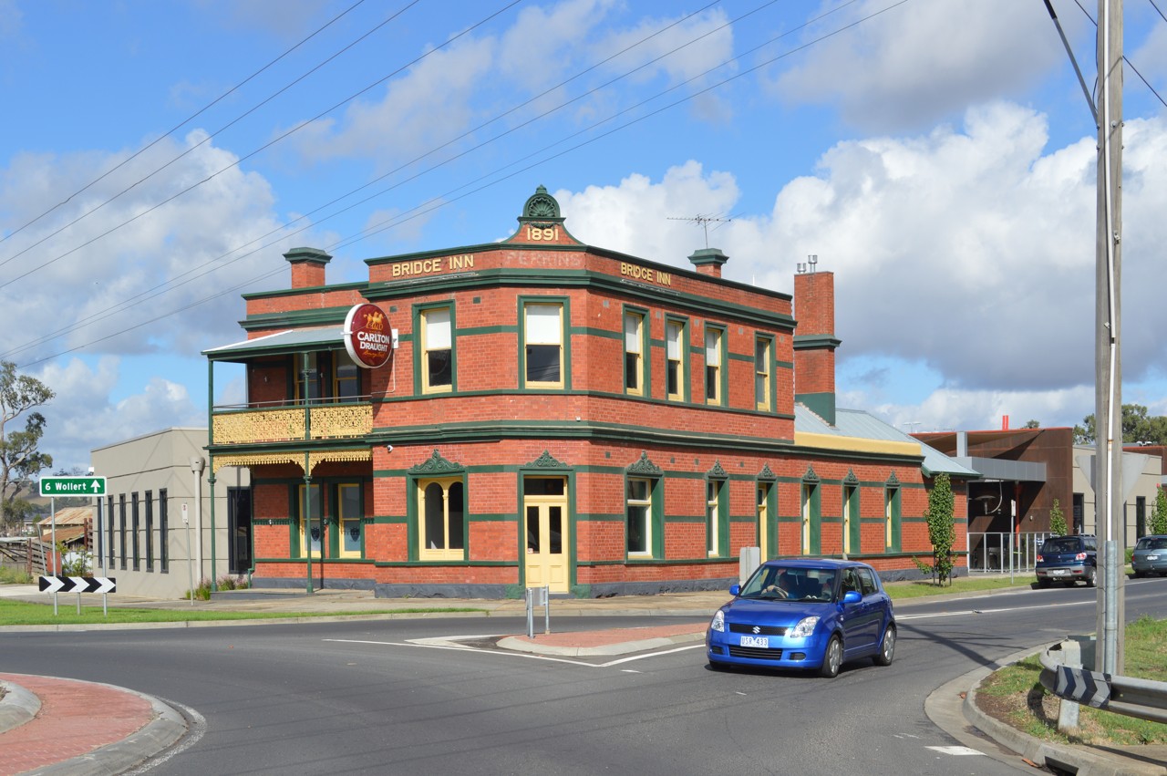
Mernda, VIC, Two-storey red brick pub on street corner

Two-storey red brick pub on street corner

Mattinbgn · CC BY 3.0

The quick read on

Mernda

VIC 3754 · Whittlesea

What homes cost, how rents have moved, and a feel for the people who call it home.

Median house
$750,000

latest suburb median

Median unit
$550,000

latest suburb median

Population
23,369

ABS 2021

Postcode
3754

Mernda, Victoria

Property market insights for Mernda

Median sale price and rental income of properties in Mernda VIC

Median price trend for houses

Based on 367 sales in the preceding 12 months

$750,000

Up 4.2% over 12 months

$800k$700k$600k20212023202420252026
2 bed
$540k
3 bed
$690k
4 bed
$774k
5+ bed
$1.05m

Median rent trend for houses

Based on 492 rental listings in the preceding 12 months

$550 per week

No change over 12 months

$550$500$450$40020212023202420252026

Market data updated October 2026.

The median house price in Mernda, VIC is currently $750,000, based on the latest 12 months of sales. Mernda has a 12-month growth rate of 4.2% for houses and 0.0% for units.

Two-bedroom houses have a median sale price of $540,000, Three-bedroom houses have a median sale price of $690,000, Four-bedroom houses have a median sale price of $774,000, Larger houses have a median sale price of $1,050,000 in Mernda.

If you're looking to lease, the median rent for houses in Mernda is $550 per week. The median house rent has remained unchanged over the last 12 months.

The median price of apartments and units for sale in Mernda is $550,000, which has remained unchanged since the same time last year. Two-bedroom apartments and units have a median sale price of $415,000, Three-bedroom apartments and units have a median sale price of $600,000, Four-bedroom apartments and units have a median sale price of $710,000 in Mernda. The median rent for units and apartments in Mernda is $480 per week and has increased 1.1% over the last 12 months.

Crime and safety

Is Mernda safe?

The overall rate for Mernda is 1,287 offences per 100,000 residents — 68% below the Greater Melbourne benchmark.

That is the clearest suburb-wide answer. Open the detailed profile to see how the pattern changes across offence types and different parts of Mernda.

Overall crime rate

1,287

offences per 100,000 residents

68% belowGreater Melbourne

MerndaGreater Melbourne: 4,001

Suburb-wide estimate from Microburbs' public crime model; it is not an address-level measure.

The people behind the postcode

Who lives in Mernda?

Mernda VIC 3754 is in Victoria, within Greater Melbourne.

23,369 people call Mernda home, with an average of 3 people per household and a median household income of $2,011 a week.

Public ABS 2021 Census figures. The bars compare the local share with the capital-region benchmark.

Population
23,369
Median age
33 years
Median mortgage
$1,937 / month
2021 household rent
$381 / week
Above the benchmarkBelow the benchmarkIn lineGreater Melbourne benchmark

Age profile

Share of residents in each age band.

Under 1527.0%Above
15–3427.0%Below
35–5431.6%Above
55–7411.9%Below
75 and over2.5%Below

Homes

Share of occupied private dwellings.

Separate houses89.4%Above
Townhouses9.1%Below
Apartments1.5%Below

Ownership

Share of homes with a stated ownership or rental status.

Owned outright14.8%Below
Paying a mortgage57.0%Above
Renting28.3%Below

Cars at home

Vehicles available to occupied households.

No car2.0%Below
One car33.0%Below
Two cars47.5%Above
Three or more17.5%In line

Getting to work

Selected ways residents worked or travelled on Census day.

Worked from home20.5%Below
Drove to work57.6%Above
Train, tram or bus2.8%Below
Walked or cycled0.6%Below

What stands out in Mernda

20.5% of workers in Mernda worked from home on Census day — less common than across Greater Melbourne.

10.3% of Mernda residents were born in India, about twice the rate across Greater Melbourne.

28.2% of people in Mernda described themselves as having no religion in the 2021 Census.

A closer look at the Census

Questions people ask about Mernda

Open any question for a plain-English reading of the public 2021 Census for Mernda VIC 3754.

Is Mernda family-friendly?Age, family structure and household size describe the community families would be joining.

27.0% of Mernda's residents were children under 15 in the 2021 Census. That is well above the Greater Melbourne average.

6,459 family households lived in Mernda; 57.0% were couple families and 16.6% were one-parent families.

55.5% of local families included children under 15. That is well above the Greater Melbourne average.

These are suburb-wide household figures, not school or childcare ratings.

What is the age profile of Mernda?The balance between younger adults, families and older residents changes how a suburb feels day to day.

Mernda had 23,369 residents at the 2021 Census.

36.8% of residents were aged 25 to 44.

14.3% were 55 or older. That is well below the Greater Melbourne average.

Age shares use the suburb’s total Census population.

What kind of homes are in Mernda?The dwelling mix shows whether the suburb is mostly detached homes, townhouses or apartments.

Separate houses made up 89.4% of occupied private dwellings in Mernda.

Townhouses and other attached homes represented 9.1% of occupied private dwellings.

Flats and apartments accounted for 1.5% of occupied private dwellings.

All three shares use occupied private dwellings as the denominator.

Do people own or rent in Mernda?Tenure shows how many households own outright, have a mortgage or rent.

14.8% of households with a stated tenure owned their home outright. That is about half the Greater Melbourne rate.

57.0% were buying their home with a mortgage.

28.3% rented their home. That is somewhat below the Greater Melbourne average.

Tenure shares include households that stated one of these three arrangements.

How large are households in Mernda?Household-size data shows the mix behind the suburb-wide average.

The average household in Mernda had 3.0 people.

One-person households made up 15.0% of occupied homes. That is well below the Greater Melbourne average.

Two-person households represented 25.8%, while 39.0% had four or more usual residents.

Household size counts usual residents in occupied homes.

How do people get to work in Mernda?Census-day travel shows the balance between home, road, public transport and active travel.

20.5% of workers worked from home on Census day. That is well below the Greater Melbourne average.

57.6% drove a car as their only travel method. That is well above the Greater Melbourne average.

2.8% used only a train, tram or bus, while 0.6% walked or cycled.

Travel figures are a 2021 Census-day snapshot.

How many cars do households have in Mernda?Vehicle availability helps describe the routines local households can support.

2.0% of occupied households had no motor vehicle available. That is about half the Greater Melbourne rate.

One-car households formed 33.0% of the total.

65.0% of households had two or more vehicles.

Vehicle counts refer to occupied households, not individual residents.

Who's moving to Mernda, and who stays?Address history shows how settled or recently mobile residents were at the Census date.

47.4% were at the same address five years earlier, while 52.6% reported a different address.

35.2% of residents were born outside Australia. That is close to the Greater Melbourne average.

Mobility figures cover residents who answered the relevant Census question.

What languages are spoken in Mernda?Language at home gives a direct view of the community’s everyday linguistic mix.

56.9% of residents used only English at home.

39.1% used a language other than English at home.

1.4% spoke Mandarin at home, 0.5% spoke Cantonese and 3.0% spoke Hindi.

Home language is separate from English proficiency.

Where were Mernda residents born?Birthplace adds another layer to the local story, separate from ancestry and language.

35.2% of Mernda's population was born outside Australia, while roughly 64.8% was born in Australia.

0.9% of residents were born in China.

10.3% were born in India, while Australian citizenship across the whole suburb stood at 82.9%.

Birthplace, citizenship and ancestry describe different parts of identity.

What ancestries shape Mernda?Ancestry responses show how residents describe family and cultural background.

English ancestry accounted for 21.0% of ancestry responses in Mernda.

Australian ancestry made up 22.9% of responses.

Chinese ancestry represented 3.0% of responses.

People may nominate more than one ancestry, so these are shares of responses.

What work do people do in Mernda?Occupation describes a person’s role; industry describes the sector employing them.

20.9% of employed residents worked in professional occupations. That is somewhat below the Greater Melbourne average.

Managers accounted for 10.3% of employed residents, while clerical and administrative workers made up 14.0%.

Health care and social assistance employed 17.6% of workers, and education and training employed 8.1%.

Occupation and industry figures describe employed residents of the suburb.

How active is the workforce in Mernda?Participation, employment pattern and unemployment describe the resident labour force.

The labour-force participation rate was 71.0%, compared with 64.1% across Greater Melbourne.

41.7% of residents aged 15 and over worked full time, while 20.9% worked part time.

Unemployment was 5.7%, compared with 5.3% across Greater Melbourne.

Labour-force figures come from the 2021 Census.

What does the health profile of Mernda show?Selected long-term health conditions help describe community service needs.

68.3% reported no selected long-term health condition.

7.3% reported a long-term mental health condition, including depression or anxiety.

7.7% reported asthma, 5.4% arthritis and 4.2% diabetes excluding gestational diabetes.

These are self-reported suburb-wide Census figures, not address-level health risks.

How educated is Mernda?Qualifications describe the study pathways represented among local residents.

27.7% of people in the qualifications table held a bachelor degree. That is somewhat below the Greater Melbourne average.

Postgraduate degrees accounted for 12.2% of qualification responses.

Diploma-level qualifications represented 18.6%, while certificate-level qualifications represented 29.4%.

Qualification categories are reported separately and are not school ratings.

What do incomes and housing costs look like in Mernda?Census income and household payments give historical context for local living costs.

Median household income was $2,011 per week in the 2021 Census.

The median monthly mortgage repayment reported by local households was $1,937.

Occupied renting households reported a median rent of $381 per week.

These household figures are from 2021; current sale and asking-rent medians appear in the market section.

How does Mernda compare with Greater Melbourne?A few clear differences place the suburb in its wider metropolitan context.

Working from home was 20.5% in Mernda, compared with 28.8% across Greater Melbourne.

Outright ownership was 14.8% locally and 30.7% across Greater Melbourne. That is about half the Greater Melbourne rate.

Renting accounted for 28.3% in Mernda, against 31.1% across Greater Melbourne.

Capital-region comparisons use the same Census definitions and year.

Three useful questions

A buyer’s quick guide to Mernda

Is Mernda expensive?

The median house price is $750,000, while units and apartments sit at $550,000. Bedroom count, land and condition still create a wide range around those suburb medians.

Is Mernda good for families?

The Census counted 6,459 local families, and 27.0% of residents were under 15. That describes the community; school quality, travel times and the right fit for a particular family need separate research.

What can I get for $1.5m in Mernda?

Larger houses have a median around $1,050,000, the closest bedroom benchmark we hold to a $1.5m budget. Individual homes can differ substantially with block size, renovation and location.

Medians describe recorded market activity across the suburb; they are historical context, not a valuation or forecast for an individual home.

Explore the area

Streets and suburbs around Mernda

460 streets in Mernda

Street-by-street reports are not published yet. The streets below are the ones this suburb covers.

  • Abundant Avenue
  • Acacia Walk
  • Ainslie
  • Aleman
  • Alessia Gr
  • Alliance Ave
  • Allsop Ave
  • Ambridge St
  • Amy
  • Annac Ave
  • Annandale Dr
  • Apele Pl
  • Apricot Ave
  • Aralia
  • Arbour St
  • Argyle Dr
  • Arthurs Creek Road
  • Arum
Show all 460 streets
  • Ashgrove Cr
  • Asplin Cct
  • Autumn Gr
  • Avoca Ave
  • Bagend Ct
  • Bagshot Cct
  • Balerno
  • Balfour Dr
  • Balvicar
  • Barkly Pl
  • Basilica Vsta
  • Bayliss St
  • Bayview Circuit
  • Beale St
  • Bedstraw St
  • Beechwood Ct
  • Bellini
  • Belloza
  • Bent St
  • Bickerton Crescent
  • Bidgee
  • Bidwell St
  • Bindaree Ct
  • Bindts Rd
  • Black Braes Bvd
  • Blackcurrant Cct
  • Blackwattle Ct
  • Blaimore
  • Borrack Cr
  • Borthwick Rd
  • Bouquet Cl
  • Boyce Bvd
  • Brahe Dr
  • Brandybuck Ln
  • Braveheart Gr
  • Braywood Tce
  • Breadalbane Ave
  • Brendan St
  • Brewster
  • Brickwell Ln
  • Bridge Inn Rd
  • Brindabella
  • Brinkhill Dr
  • Brunton Dr
  • Bunyip
  • Burgess St
  • Burnside Way
  • Burrell
  • Buttercross
  • Callaway Cr
  • Calmos Ave
  • Campania Ln
  • Canico Cr
  • Cantona Pwy
  • Carissa Dr
  • Carlson Ave
  • Carr
  • Carriageway
  • Cassinias Gr
  • Castello St
  • Cattlemen
  • Cavalry Ave
  • Cavender St
  • Chanticleer Dr
  • Chatsworth Ave
  • Chicory St
  • Chiswick Pl
  • Clanedin Ave
  • Cloughs Rd
  • Clutha Dr
  • Clyde Rd
  • Coates Ct
  • Cochranes Rd
  • Cockerell Road
  • Cockrell Rd
  • Coe St
  • Coleen St
  • Coliban Dr
  • Command Rd
  • Connors Rd
  • Copperhead St
  • Coppice St
  • Cordoba
  • Cortona Gra
  • Cotswold
  • Craigmoor Cr
  • Cravens Rd
  • Croft St
  • Cropley Tce
  • Crossing Rd
  • Cummins Ct
  • Dairyside Ln
  • Dalmeny
  • Dalwhinnie Cl
  • Dalziel Dr
  • Damask
  • Dane Drive
  • Dante
  • Darvel Dr
  • Day Cl
  • Decameron
  • Delbridge Dr
  • Destiny
  • Dogwood
  • Dorbolo St
  • Doric
  • Dorset
  • Drewes Ln
  • Ducal Pwy
  • Dunedin St
  • Durer
  • Dynan St
  • Eaglehawk Dr
  • Earthmore Rd
  • Eldorado
  • Elmore
  • Elm Tree Pl
  • Emilia Ch
  • Erindale
  • Erskine Rd
  • Eternity St
  • Etherington Dr
  • Eugenia St
  • Everard Rd
  • Everton Dr
  • Eyebright Rd
  • Falkirk Dr
  • Farmington Rd
  • Farmstead
  • Fashoda Dr
  • Fielding Dr
  • Florence Dr
  • Flourmill Dr
  • Flowerdale Ct
  • Foundry St
  • Foxwood Gr
  • Francesca Dr
  • Friesian St
  • Gael Ct
  • Gallagher
  • Galle
  • Galloway Dr
  • Gellibrand
  • Georgia Dr
  • Geranium Gr
  • Giddens Rd
  • Ginninderry Gra
  • Gledhill
  • Glenample Pl
  • Goadby Dr
  • Godwin St
  • Gosling St
  • Goulburn St
  • Graff Rd
  • Grafton St
  • Greenaway St
  • Greenside
  • Greig Dr
  • Gridley St
  • Grimsthorpe Pl
  • Grove St
  • Gumleaf Ave
  • Haig St
  • Halliday Rd
  • Hanley St
  • Hardie St
  • Harriers St
  • Harrison St
  • Harvard Ave
  • Hatfield Dr
  • Hathfelde Bvd
  • Hayes Rd
  • Hazel Glen Dr
  • Heals Rd
  • Heartlands Ln
  • Heddle Pde
  • Henrietta Ave
  • Henwood
  • Herschel
  • Hickling Rd
  • Hideaway Pl
  • Hillgrove
  • Hinterland Dr
  • Hodgson
  • Hollaway Dr
  • Homebush Ave
  • Hopkins St
  • Hovell St
  • Hunters Rd
  • Hurrey Ave
  • Iceberg Dr
  • Inverness Rd
  • Jackaroo St
  • Jane Ct
  • Jetstream Dr
  • Johnsons Rd
  • Jondarvan Dr
  • Jupiter Ave
  • Kage Gr
  • Kalkallo
  • Keelangie
  • Kepler St
  • Kernaghan Dr
  • Kerrabee Dr
  • Kilburnie Dr
  • Kilpatrick St
  • Kincaid Dr
  • Kingview Pl
  • Kruger St
  • Labassa Ct
  • Langdon Dr
  • Lang Lang
  • Lawn
  • Leith Dr
  • Leonardo Dr
  • Lerderderg
  • Levanter
  • Levens Ln
  • Licodia Pde
  • Livestock St
  • Livingston St
  • Lockhart St
  • Lombardy Dr
  • Lone Pine Dr
  • Lorenzo
  • Louvre Ln
  • Lucca
  • Lucerne St
  • Lunan Rd
  • Lupin St
  • Luther
  • Maahu
  • Macalister St
  • Macqueen St
  • Maize Pl
  • Mandarin Ct
  • Mango Cr
  • Maremma Dr
  • Marlowe Gra
  • Marot
  • Marsala
  • Masons Rd
  • Massa Dr
  • Mateo
  • Maurice
  • Maximus Pl
  • Mccubbin
  • Mcculloch St
  • Mea Cct
  • Meade
  • Medici Pl
  • Melliodora Dr
  • Melrose Cct
  • Merino Dr
  • Mernda Village Dr
  • Merriweather Ln
  • Mervyn Dr
  • Messina St
  • Millet St
  • Millicent Ct
  • Millstream
  • Mintbush Gra
  • Mitta Mitta Ave
  • Moe
  • Monarch Ave
  • Moorland
  • Mortar Rdge
  • Morwell
  • Mowbray St
  • Muir
  • Murmungee Ave
  • Muswellbrook Gr
  • Mutton Ln
  • Nabha Road
  • Neptune Tce
  • Newington Pde
  • Newland
  • Niccoli Pwy
  • Nimble St
  • Nisha Pl
  • Nissoria Ave
  • Oakwood St
  • Oatmeal
  • Observer Tce
  • Old Plenty Rd
  • Onslow
  • Opaque Pl
  • Ophir
  • Oxford St
  • Padthaway Pl
  • Paisley Cr
  • Palazzo Tce
  • Palladio
  • Parisel Cct
  • Parkedge Bvd
  • Parkwood Rd
  • Partytree
  • Passionfruit Cr
  • Pasture Cr
  • Pattomkate Gr
  • Pearson Rd
  • Perry St
  • Petworth Cl
  • Pietas Pl
  • Pimpinella
  • Pipers Ln
  • Pisa
  • Pittaway St
  • Plantation Ave
  • Plenty Rd
  • Plough St
  • Plugges St
  • Plume Dr
  • Pluto Gr
  • Poets Ct
  • Polwarth Rd
  • Pomaderris Dr
  • Pomegranate Gr
  • Popes Ave
  • Porepunkah St
  • Posy Ln
  • Powers St
  • Powlett St
  • Prosperity Pl
  • Pugh St
  • Pura
  • Pythagoras St
  • Questo
  • Ragusa Tce
  • Raitt Gr
  • Ramez St
  • Ramicorn
  • Raspberry Gr
  • Rayfield Rd
  • Redstone Ave
  • Redwater Dr
  • Regent St
  • Renaissance Bvd
  • Reynolds Cct
  • Riberry Cr
  • Ricketts Ln
  • Riordan Cr
  • Rippon Lea Pde
  • Riverdale Boulevard
  • Ronsard Cr
  • Rousham Pl
  • Rowanval Tce
  • Rowell Dr
  • Ryan Rd
  • Rye Rd
  • Sackville St
  • Sambell St
  • San Sisto
  • Saphire
  • Sapling Pl
  • Schotters Rd
  • Scotchmer Cr
  • Scottsdale Rd
  • Scuffam St
  • Shade Ave
  • Shanks
  • Shearwater Pl
  • Shepherds
  • Shout St
  • Shrapnel Rd
  • Shura Dr
  • Siena Dr
  • Silverwood Dr
  • Sir John Tce
  • Sissinghurst Pde
  • Sistine
  • Situation
  • Skeeter Dr
  • Smythe Ave
  • Softwood Dr
  • Sommerville Ave
  • Southdown
  • Southerly Dr
  • Speedwell St
  • Spencer Tce
  • Splitters St
  • Stamlor Rd
  • Station Rd
  • St Boswells St
  • St John Terrace
  • St Marks Ct
  • Stockyard Street
  • Stonemasons
  • Stourhead Ave
  • St Pauls Tce
  • Strachan
  • Stradling
  • Strathdale St
  • Strider St
  • Sumner Dr
  • Sunnybrae Dr
  • Sunridge Dr
  • Tangelo Gr
  • Tarwin Dr
  • Tawonga Ln
  • Texel Dr
  • The Parkway
  • Throssell St
  • Tilia
  • Titian
  • Todd
  • Toolern Dr
  • Treemont Tce
  • Trevi Dr
  • Trimble
  • Trooper St
  • Tubb St
  • Tyers
  • Uccello
  • Umbria Rd
  • Underhill Rd
  • Vasari
  • Veneto
  • Vestley Dr
  • Viewpoint Ave
  • Village
  • Villeroy St
  • Vittorio Rd
  • Wagonwheel St
  • Wandana
  • Ware St
  • Watercolour Dr
  • Waterview Dr
  • Waterwheel Gr
  • Wellington St
  • Westgarth Rd
  • Westhorpe Cr
  • Whitta Pl
  • Wildflower Gr
  • Wilkes Ct
  • Wilkinson St
  • William St
  • Womble
  • Woolshed Ave
  • Yering Dr
  • Yoemans Dr
  • Zevos St

Keep exploring

Is Mernda right for your search?

Use the finders to compare places and properties, or open the full report when you need the street, risk, schools and growth research.

Figures update as new market and census data arrives. This suburb overview is general information, not a valuation or financial advice.